Community Corner
Take A Hike Comes to Pillar Point Bluff Near Half Moon Bay
County's series of monthly hiking events comes to Moss Beach and Montara.
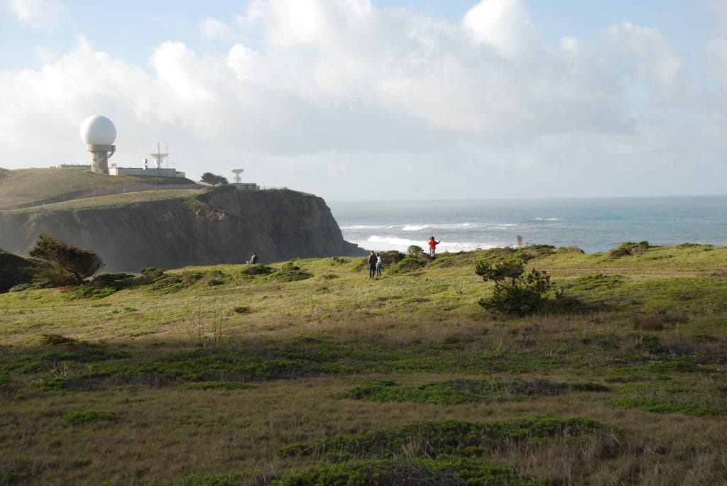

Hikers and their canine companions are invited to join a guided hike this Saturday on August 13 at Pillar Point Bluff and the . Coordinated by Take A Hike San Mateo County, the three-mile, 45-minute route just outside Half Moon Bay in Moss Beach and Montara promises hikers views of the , open space, and ocean vistas as far as the eye can see.
Well known for its beaked and winged population of locals, Pillar Point Bluff offers a good opportunity for hikers to do some casual . Park rangers and volunteer docents will provide interpretation of the area's history and natural habitat.
Hikers will meet at 9 a.m. in the parking lot of the Jean Lauer Trail at Pillar Point Bluff (see directions below). They are advised to bring water, dress in layers and wear a hat. Applying sunscreen is also recommended. Dogs will be required to be on a leash at all times, and will not be allowed to go off-trail. Dogs are not allowed on the Fitzgerald Marine Reserve Beaches.
Find out what's happening in Half Moon Baywith free, real-time updates from Patch.
The Take A Hike program was founded three years ago by county supervisor Rose Jacobs Gibson. The program aims to encourage residents to be active and discover the county's parks and trails.
Upcoming hikes this fall are San Pedro Valley Park (September 24) and Coyote Point Recreational Area (October 29). This Saturday's Pillar Point Bluff hike is the only location on the 2011 schedule that allows dogs.
Find out what's happening in Half Moon Baywith free, real-time updates from Patch.
As a incentive for participation, the program will be awarding a prize to individuals who join at least three Take A Hike programs by September. The first 100 hikers who attend next month's hike and submit a log showing at least three hikes will receive pedometers. The 2011 Take A Hike Participant Log can be printed by clicking on the PDF form in the media box to the right.
Directions: From Half Moon Bay, go north on Highway 1 for 6 miles. After passing the Half Moon Airport and Cabrillo Farms, turn left onto Cypress Avenue. After 0.3 miles, turn left onto Airport Street and continue for 0.9 miles. A parking lot and Jean Lauer Trail staging area will be on the right.
For more information, call (650) 599-1009, explore the program's website or visit its Facebook page.
To receive news feeds about Half Moon Bay and the unincorporated Coastside between Montara and Pescadero, visit Half Moon Bay Patch on Facebook and "like" us here. Follow us on Twitter here.